Teaching Geography with Maps
Geography is about where things are, so ask students to point. Map questions where they tap the place, what a wrong tap tells you, and question ideas that go beyond “where is it?”.
 By the Giga Quizzes team4 min read
In this post
“What is the capital of Kenya?” tests a fact from a list. “Tap Kenya on this map” tests whether a student knows where it is, which is what geography is really about. Many geography quizzes never show a map at all, and that is a missed chance: a map question is quicker to answer, harder to guess and tells you far more about what a student is thinking. Here is how to build map questions that work on a phone and on a projector, and what to do with the answers.
Let them point
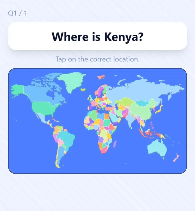
The most useful geography question shows a map and asks students to find something on it. In Giga Quizzes this is a Hotspot question: you add the map as the picture and paint over the place that counts, by brush or with a box or a circle, and students tap the map on their own phones. Any tap inside the painted area counts as right.
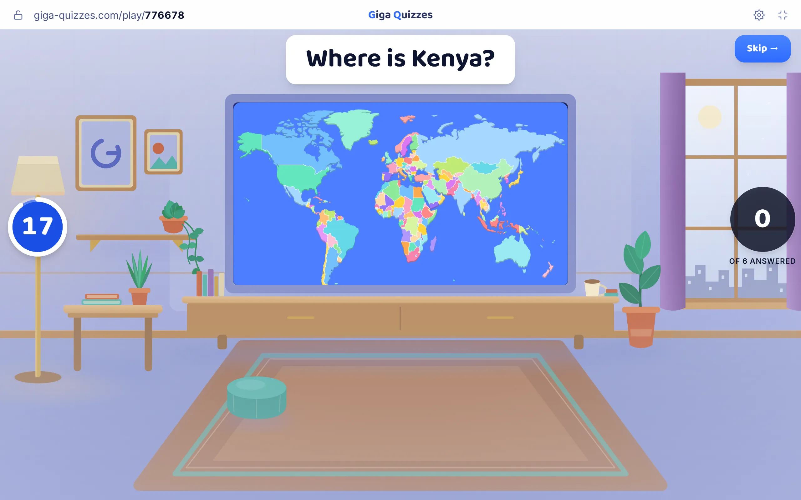
On the student’s side there is nothing to read but the question and nothing to type. That makes map questions some of the fastest in any quiz, and some of the fairest for students who are still learning the language of instruction.
What a wrong tap tells you
A multiple-choice answer is either right or wrong. A tap on a map is right, nearly right, or wrong in an interesting way. A student who taps Tanzania when asked for Kenya knows East Africa and has mixed up two neighbours. A student who taps West Africa has the continent but not the region. A student who taps South America has a bigger gap. Those are three different conversations, and the reveal, which puts a dot on the map for every tap in the room, shows you which one to have.
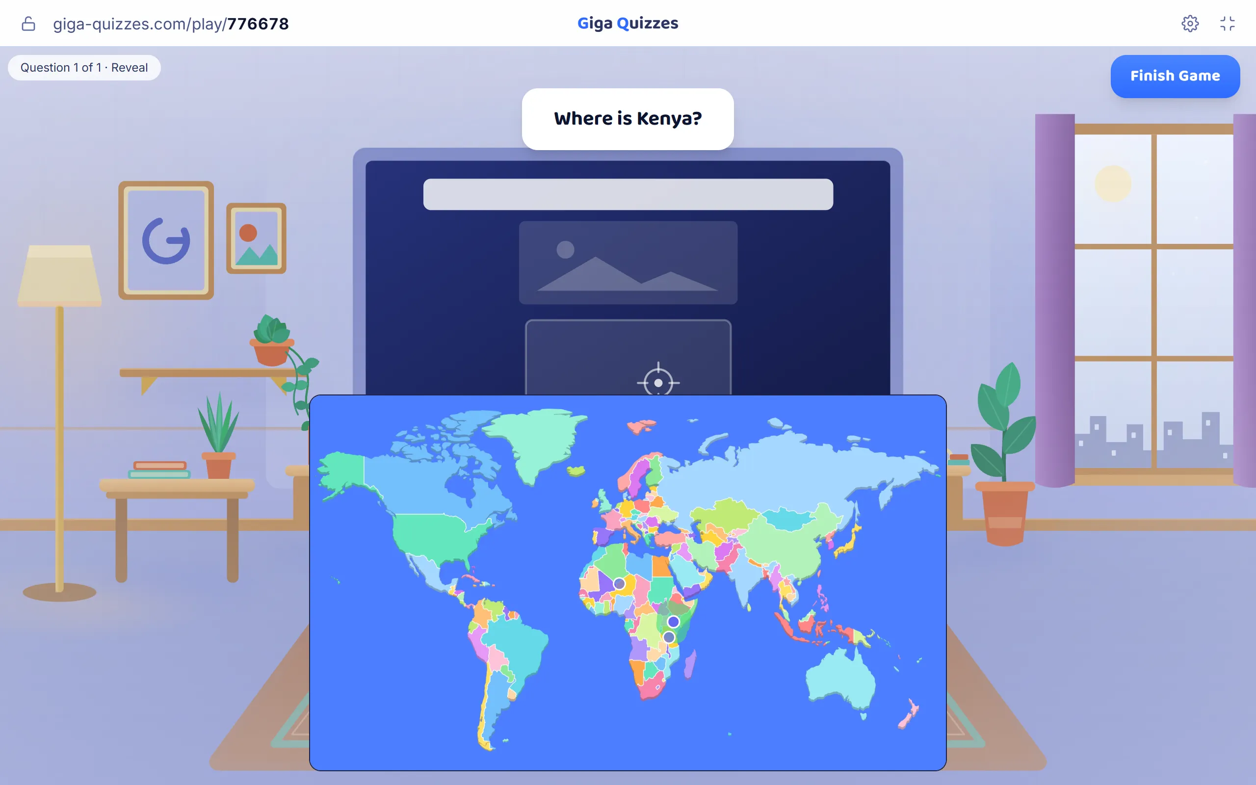
At the reveal, ask a student who got it right how they found it. The answers are usually landmarks of their own: “It’s on the coast, under Ethiopia”, “The Equator goes through it”. Those mental anchors are exactly what the rest of the class needs to borrow.
Choosing and marking a map
- No labels. A labelled map gives the answer away. Use an outline or blank map; Natural Earth publishes public-domain map data, and many blank maps are free to use.
- Strong borders and colours. The map will be read on a small phone screen and a washed-out projector, so thin lines and pale shades disappear.
- The right zoom. If the place is a speck on the map, the question is a test of eyesight. Zoom in to a continent or region instead of the whole world.
- A generous area. Paint a little beyond the real border of a small country, so a student who knows where it is is not marked wrong for being a few pixels out.
Beyond “where is it?”
Map taps are the heart of a geography quiz, but other question types test the sense of place from different angles:
| Question | Example | Answer |
|---|---|---|
| Put in order | These cities from north to south: Rome, Oslo, Cairo, Paris | Oslo, Paris, Rome, Cairo |
| Put in order | These mountains from highest: Mont Blanc, K2, Everest, Kilimanjaro | Everest, K2, Kilimanjaro, Mont Blanc |
| Slider | How high is Kilimanjaro, in metres? | About 5,895 m; give credit for being close |
| Picture answers | Which of these is the flag of Japan? (Japan, Bangladesh, Palau, Laos) | The white flag with the red disc |
| Matching | Match each country to its capital: Australia, Canada, Brazil, Turkey | Canberra, Ottawa, Brasília, Ankara |
The capitals in that last row are chosen on purpose: each country has a bigger, better-known city that many students will pick instead. A question where the tempting answer is wrong is worth more than one where every option is a wild guess.
Start big, then zoom in
The same kind of question grows with the class. Younger students can find continents and oceans on a world map. Older ones can find countries, then mountain ranges and rivers, then cities. The most memorable map quiz of all is often a local one: a map of your own town with the river, the hills, the station and the school to find. Students who cannot place Kenya will compete fiercely to find their own street.
Keep facts that stay true. Heights, distances and positions do not change from one year to the next; populations and record holders do, and a question that was right last year can quietly become wrong.
See a map quiz in action
To see how a map quiz plays before building your own, try Can You Find It on the Map? on Discover, where every question shows the world map and players tap the country it names. You can host it as it is, or add it to your library and change it for your class. For younger students there is also an easy world flag quiz.
Try it in Giga Quizzes
Free, in the browser, and nothing for your students to install. These guides show each step on the real screens.
New to Giga Quizzes?
Free live quizzes in the browser. Students join from any phone, with no app.
Make your first quiz →